Geophysics in Anaheim provides a non-invasive subsurface exploration strategy essential for understanding complex soil and bedrock conditions before physical excavation begins. Our geophysical surveys cover a broad spectrum of techniques designed to map stratigraphy, locate utilities, and identify anomalies such as voids or groundwater channels without disturbing the site. The local geology is dominated by alluvial deposits from the Santa Ana River, interbedded with fine-grained sediments and cobbles, which can create significant lateral variability. To comply with local regulations, our reporting adheres to the City of Anaheim Public Works standards and the California Building Code Chapter 18, ensuring your site characterization aligns with investigation protocols and seismic safety requirements. When surface methods suggest deep irregularities, we often integrate findings with direct physical methods like the exploratory test pit to validate geophysical signatures.
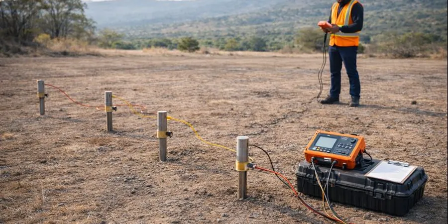
Our field methodology strictly follows current ASTM International standards to deliver legally defensible and technically robust data. We primarily employ Multi-channel Analysis of Surface Waves (MASW) and Electrical Resistivity Tomography (ERT) to generate 2D and 3D profiles of shear-wave velocity and subsurface resistivity, respectively. These geophysical techniques are calibrated against mechanical data obtained from SPT (Standard Penetration Test) borings, allowing us to correlate geophysical properties directly with engineering parameters like relative density. For near-surface characterization, we follow ASTM D6431 for ground penetrating radar, while seismic refraction adheres to ASTM D5777. This integrated approach reduces the ambiguity often associated with isolated In-Situ, providing a continuous image of the subsurface between discrete sampling points.
In Anaheim, geophysical surveys are critical for the high-density urban redevelopment and infrastructure upgrades surrounding major commercial zones and the Platinum Triangle. We frequently deploy these methods for seismic site class determinations (Vs30) required on commercial high-rises and for detecting undocumented backfill in brownfield redevelopment projects. Before conducting any soil compaction verification with the field density test (sand cone method), our utility locating services prevent costly strikes against existing infrastructure. Furthermore, for projects investigating deep seated landslides or fault traces near the Puente Hills, we pair seismic profiling with Flat Dilatometer Test (DMT) data to constrain deformation moduli without extensive drilling.
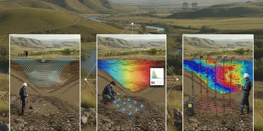
Our process begins with a desktop review of historic geologic maps followed by an active field survey using an array of geophones and electrodes tailored to your target depth. The raw data is processed through inversion software to produce final contour maps and cross-sections. Deliverables include a comprehensive report interpreting the geophysical stratigraphy, the location of any anomalous zones, and a correlation table linking geophysical results to geotechnical index properties obtained from undisturbed sampling (Shelby tube) and our laboratory testing. By merging non-destructive imaging with targeted physical sampling, we minimize your project's risk profile and optimize foundation design, offering a complete geological model that saves time and reduces the need for extensive earthwork.